FAQ
Frequently Asked GIS Questions
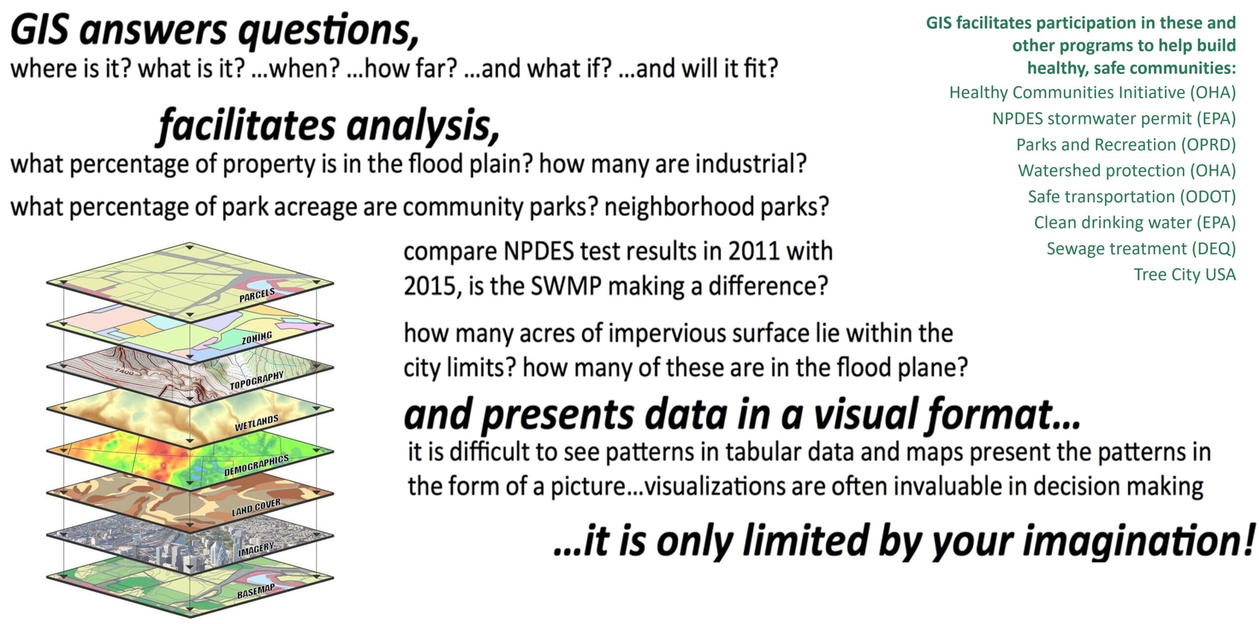
“A geographic information system (GIS) lets us visualize, question, analyze, interpret, and understand data to reveal relationships, patterns, and trends.” [Esri]
GIS is a spatial data management and decision making tool that consists of people, software, and data. GIS assists with documenting the real world in digital format with a graphic user interface. Visit our main GIS page and check out some of our interactive mapping applications.